Tag:leisure=bike_park
 |
| Description |
|---|
| An area designed for practising cycling skills, usually featuring obstacles, jumps, berms or technical trail features. May be designed for BMX, mountain bikes, dirt jumping, pump tracks or skills areas. |
| Group: sports |
| Used on these elements |
| Useful combination |
| Status: proposed |
| Tools for this tag |
The tag leisure=bike_park is used to map a bike park: an area designed for recreational cycling or skill practice, often featuring man-made obstacles, dirt jumps, berms, technical trail features, pump tracks, or skills loops.
These facilities can be aimed at BMX, mountain biking, dirt jumping, freeride, or urban cycling skills.
A downhill mountain bike facility covering a large area may be mapped as multiple leisure=bike_park polygons for distinct zones, or with mtb:scale=* to indicate difficulty.
How to map
- If there is a clearly defined physical outline (fence, boundary, vegetation, or facility perimeter), draw an
 area around it and add
 leisure=bike_park. - If the bike park consists of individual features without a clear outer boundary, draw a
 node at the centre and tag it with
 leisure=bike_park. - Additional details such as surface, lighting, or difficulty level can be added with
surface=*,lit=*, andmtb:scale=*. - If the facility is disused, its status can be indicated using the Lifecycle prefix, e.g.
disused:leisure=bike_parkorabandoned:leisure=bike_park.
Tags used in combination
bicycle=*– Indicates general bicycle access (yes/no/designated)mtb:scale=*– Difficulty rating for mountain bike trails or featuressurface=*– Describes the main surface (e.g., dirt, asphalt, concrete)lit=*– Whether the area is lit at nightaccess=*– To specify public, private, or restricted access
Examples
- Swiss Bike Park Oberried in Oberried, Switzerland
- A small bike park at Bruntwood Park in Cheadle, England
- Puro Flow Bikepark in Mexico City, Mexico
- Hinton Bike Park in Hinton, Canada
- Bikepark Bad Saulgau in Bad Saulgau, Germany
-
La Poma Bikepark in Premià de Dalt, Spain
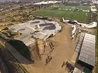
-
.JPG) The Ruby Hill Bike Park in Denver, Colorado
The Ruby Hill Bike Park in Denver, Colorado -
.jpg) Downhill trails at Les Gets Bike Park in Les Gets, France
Downhill trails at Les Gets Bike Park in Les Gets, France -
 Slopestyle course at Whistler Mountain Bike Park in Whistler, Canada
Covered and indoor bike parks
Indoor or covered bike parks should be mapped as separate ![]() node or
node or ![]() area objects inside the building outline.
A covered park should be tagged with
area objects inside the building outline.
A covered park should be tagged with covered=yes, an indoor one with indoor=yes and possibly level=*.
Possible tagging mistakes
See also
leisure=track– For non-motorized racing tracks, including cycling velodromes and time trial circuitshighway=cycleway– Designated cycle paths, typically for transport rather than skill practiceleisure=sports_centre– A sports facility that may include a bike park as part of its offerings- Key:mtb:scale – Mountain bike difficulty rating
- Proposed_features/Bike_park – Original proposal