Province of Como
Province of Como
| |
|---|---|
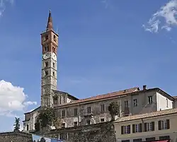
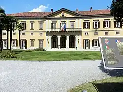 Villa Saporiti, the seat of the province | |
 Coat of arms | |
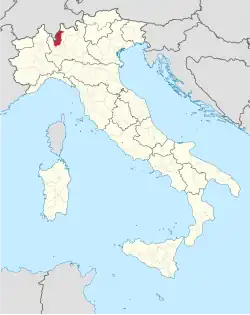 Map highlighting the location of the province of Como in Italy | |
| Coordinates: 45°49′N 9°5′E / 45.817°N 9.083°E | |
| Country | |
| Region | Lombardy |
| Capital(s) | Como |
| Comuni | 160 |
| Government | |
| • President | Fiorenzo Bongiasca |
| Area | |
• Total | 1,279 km2 (494 sq mi) |
| Population (1 January 2015) | |
• Total | 599,905 |
| • Density | 469.0/km2 (1,215/sq mi) |
| GDP | |
| • Total | €16.310 billion (2015) |
| • Per capita | €27,193 (2015) |
| Time zone | UTC+1 (CET) |
| • Summer (DST) | UTC+2 (CEST) |
| Postal code | 22100 |
| Telephone prefix | 031 0344 02 0331 |
| ISO 3166 code | IT-CO |
| Vehicle registration | CO |
| ISTAT | 013 |
| Website | www |
.svg.png)
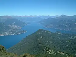
The province of Como (Italian: provincia di Como; Comasco: pruincia de Comm) is a province in the Lombardy region of Italy. It borders the Swiss cantons of Ticino and Grigioni to the north, the Italian provinces of Sondrio and Lecco to the East, the province of Monza and Brianza to the south and the province of Varese to the West. The city of Como is its capital—other large towns, with more than 10,000 inhabitants, include Cantù, Erba, Mariano Comense and Olgiate Comasco. Campione d'Italia also belongs to the province and is enclaved in the Swiss canton of Ticino. The Lugano Prealps cover the territory of the province, and the most important body of water is the glacial Lake Como.
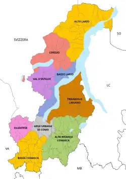
Municipalities
| Year | Pop. | ±% |
|---|---|---|
| 1951 | 361,667 | — |
| 1961 | 405,975 | +12.3% |
| 1971 | 476,209 | +17.3% |
| 1981 | 511,425 | +7.4% |
| 1991 | 522,147 | +2.1% |
| 2001 | 537,500 | +2.9% |
| 2011 | 586,735 | +9.2% |
| 2021 | 594,941 | +1.4% |
| Source: ISTAT | ||
As of 31 December 2017, the main comuni (sg.: comune) by population are:

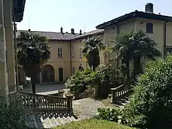
.JPG)


| City | Population |
|---|---|
| Como | 83,320 |
| Cantù | 39,917 |
| Mariano Comense | 24,908 |
| Erba | 16,365 |
| Olgiate Comasco[2] | 11,651 |
| Lomazzo | 9,945 |
| Lurate Caccivio | 9,893 |
| Fino Mornasco | 9,845 |
| Turate | 9,506 |
| Cermenate | 9,204 |
The full list is:
- Albavilla
- Albese con Cassano
- Albiolo
- Alserio
- Alta Valle Intelvi
- Alzate Brianza
- Anzano del Parco
- Appiano Gentile
- Argegno
- Arosio
- Asso
- Barni
- Bellagio
- Bene Lario
- Beregazzo con Figliaro
- Binago
- Bizzarone
- Blessagno
- Blevio
- Bregnano
- Brenna
- Brienno
- Brunate
- Bulgarograsso
- Cabiate
- Cadorago
- Caglio
- Campione d'Italia
- Cantù
- Canzo
- Capiago Intimiano
- Carate Urio
- Carbonate
- Carimate
- Carlazzo
- Carugo
- Caslino d'Erba
- Casnate con Bernate
- Cassina Rizzardi
- Castelmarte
- Castelnuovo Bozzente
- Cavargna
- Centro Valle Intelvi
- Cerano d'Intelvi
- Cermenate
- Cernobbio
- Cirimido
- Claino con Osteno
- Colonno
- Colverde
- Como
- Corrido
- Cremia
- Cucciago
- Cusino
- Dizzasco
- Domaso
- Dongo
- Dosso del Liro
- Erba
- Eupilio
- Faggeto Lario
- Faloppio
- Fenegrò
- Figino Serenza
- Fino Mornasco
- Garzeno
- Gera Lario
- Grandate
- Grandola ed Uniti
- Gravedona ed Uniti
- Griante
- Guanzate
- Inverigo
- Laglio
- Laino
- Lambrugo
- Lasnigo
- Lenno
- Lezzeno
- Limido Comasco
- Lipomo
- Livo
- Locate Varesino
- Lomazzo
- Longone al Segrino
- Luisago
- Lurago Marinone
- Lurago d'Erba
- Lurate Caccivio
- Magreglio
- Mariano Comense
- Maslianico
- Menaggio
- Merone
- Mezzegra
- Moltrasio
- Monguzzo
- Montano Lucino
- Montemezzo
- Montorfano
- Mozzate
- Musso
- Nesso
- Novedrate
- Olgiate Comasco
- Oltrona di San Mamette
- Orsenigo
- Ossuccio
- Peglio
- Pianello del Lario
- Pigra
- Plesio
- Pognana Lario
- Ponna
- Ponte Lambro
- Porlezza
- Proserpio
- Pusiano
- Rezzago
- Rodero
- Ronago
- Rovellasca
- Rovello Porro
- Sala Comacina
- San Bartolomeo Val Cavargna
- San Fermo della Battaglia
- San Nazzaro Val Cavargna
- San Siro
- Schignano
- Senna Comasco
- Solbiate con Cagno
- Sorico
- Sormano
- Stazzona
- Tavernerio
- Torno
- Tremezzo
- Trezzone
- Turate
- Uggiate-Trevano
- Val Rezzo
- Valbrona
- Valmorea
- Valsolda
- Veleso
- Veniano
- Vercana
- Vertemate con Minoprio
- Villa Guardia
- Zelbio
Transport
Motorways
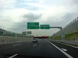
The province is crossed by the following motorways (in Italian, autostrade):
 Autostrada A9: Lainate-Como
 Autostrada A36: Cassano Magnago-Lentate sul Seveso
 Autostrada A59: Villa Guardia-Albese con Cassano
Railway lines
- Milan–Chiasso railway
- Saronno–Como railway
- Milan–Asso railway
See also
- Alessandro Volta
- Antonio Sant'Elia
- Giuseppe Terragni
References
- ^ Regions and Cities > Regional Statistics > Regional Economy > Regional Gross Domestic Product (Small regions TL3), OECD.Stats. Accessed on 16 November 2018.
- ^ dati a 30-04-2012
- ^ Lenarduzzi, Thea (30 January 2016). "The motorway that built Italy: Piero Puricelli's masterpiece". The Independent. Retrieved 12 May 2022.
- ^ "The "Milano-Laghi" by Piero Puricelli, the first motorway in the world". Retrieved 10 May 2022.
External links
- Official website
 (in Italian)
  Media related to Province of Como (category) at Wikimedia Commons
| Provinces and places |  | |
|---|---|---|
| History |
| |
| Politics and government |
| |
| Education and culture |
| |
Categories | ||