Poland/Rzeki
< Poland
| Polski:
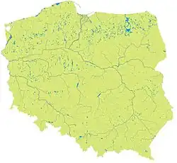
Ta strona grupuje relacje z rzekami w granicach Polski. Rendering granic można zobaczyć tutaj. |
| Tag | Komentarz Notes |
|---|---|
type=waterway
|
|
waterway=river, stream, canal, drain
|
|
name=*
|
Nazwa rzeki. |
wikipedia=*
|
Nazwa artykułu w Wikipedii (dodaj prefiks pl:, jeśli strona odnosi się do polskiej Wikipedii) |
destination=*
|
Ujście rzeki (nazwa innej rzeki lub morza, jeziora...} |
Dorzecze Wisły
| Nazwa Name |
Długość Langth |
Status | Relacja Relation |
Komentarz Notes |
|---|---|---|---|---|
| Czarna Wisełka | 9 km | 122056611 | ||
| Wisła | 1047 km | 34392 | ||
| Malinka | 8.1 km | 237043757 | ||
| Biebrza | 165 km | 6378830 | ||
| Brda | 238 km | 1289615 | ||
| Bug | 587 km | 1314266 | ||
| Bzura | 166 km | 1491983 | ||
| Drwęca | 207 km | 2712795 | ||
| Dunajec | 247 km | 2822415 | ||
| Narew | 484 km | 2278710 | ||
| Pilica | 319 km | 2698269 | ||
| Poprad | 168,8 km | 5544271 | ||
| Radomka | 98 km | 2753588 | ||
| Rudawa | 35.8 km | 2900774 | ||
| San | 443 km | 1640410 | ||
| Soła | 89 km | 545358 | ||
| Wda | 198 km | 4686023 | ||
| Wieprz | 348,9 km | 2297716 | ||
| Wilga | 26,7 km | 2900813 | ||
| Wisłok | 228 km | 2020696 | ||
| Wkra | 249 km | 2765933 |
Dorzecze Odry
| Nazwa Name |
Długość Langth |
Status | Relacja Relation |
Komentarz Notes |
|---|---|---|---|---|
| Odra | 854 km | 387605 | ||
| Bóbr | 272 km | 1582509 | ||
| Drawa | 185,9 km | 7456890 | ||
| Noteć | 391,3 km | 6124894 | ||
| Nysa Kłodzka | 181,7 km | 3510490 | ||
| Nysa Łużycka | 251,6 km | 406565 | ||
| Prosna | 216,8 km | 7456822 | ||
| Warta | 808 km | 3272339 | ||
| Widawa | 109 km | 1103925 |
Nie jest do końca pewne położenie źródła. Poza tym przebieg rzeki jest już kompletny. | |
| Bystrzyca | 101,5 km | 3205675 |
Nie jest do końca pewne położenie źródła. Poza tym przebieg rzeki jest już kompletny. |
Bezpośrednio uchodzące do Bałtyku
| Nazwa Name |
Długość Langth |
Status | Relacja Relation |
Komentarz Notes |
|---|---|---|---|---|
| Nogat | 62 km | 1645604 |
Zobacz też
Template for waterway status explanation. Use the default English text or use the template arguments for your translations.
Usage
All parameters are optional. By default, text is in English. English writers shall write their comments in the template itself (avoiding double edition). Other languages are translated in template arguments, not in the template itself.
Colour and symbol legend
The status of the waterways is indicated by a symbol, which describes the type of feature, and a colour, which indicates the completeness of that feature
Meaning of symbols
 - The Waterway is completly mapped. - Key: ww
 - The Waterbank is completly mapped. - Key: wb
 - All Tributaries are present. - Key: tr
 - The waterway is linked to a Relation. - Key: rl
Meaning of colours
| Background colour | Meaning | Use for navigation | To do | Value |
|---|---|---|---|---|
| The map needs checking, status unknown | Availability unknown | Please check | (none) | |
| The map contains no or little data | Not to be used | Please complete | 0 | |
| The map contains partial data | Limited usability | Please complete | 1 | |
| The map is largely complete (please describe missing data) | Use with restrictions | Please complete (missing data etc.) | 2 | |
| The map is complete (in the opinion of a mapper) | Suitable for use | Please check and correct any errors | 3 | |
| The map is complete (verified by 2 mappers) ; please indicate Date when checked) | Suitable for use | Please update as needed | 4 | |
| This attribute is not existing in the mapped area (e.g. no petrol station existing). | Suitable for use | Please update as needed | X |
This table is a wiki template with a default description in English. Editable here.
| ||||||||||
| ||||||||||