Hiroshima Prefecture
Hiroshima Prefecture
広島県 | |
|---|---|
| Japanese transcription(s) | |
| • Japanese | 広島県 |
| • Rōmaji | Hiroshima-ken |
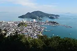
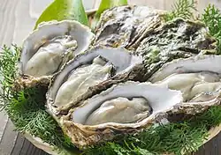
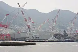
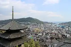
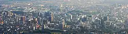
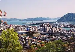
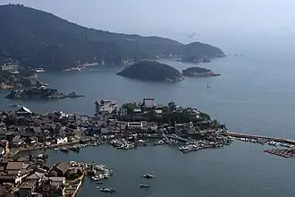
Hiroshima Peace Memorial Park Tomonoura Hiroshima Oyster Shipyard base in Kure Panoramic view of Senkoji and Onomichi Hiroshima Castle Sandan-kyō | |
 Flag  Emblem | |
 | |
| Country | |
| Region | Chūgoku (San'yō) |
| Island | Honshu |
| Capital | Hiroshima |
| Subdivisions | Districts: 5, Municipalities: 23 |
| Government | |
| • Governor | Mika Yokota (since November 2025) |
| Area | |
• Total | 8,479.63 km2 (3,274.00 sq mi) |
| • Rank | 11th |
| Population (June 1, 2019) | |
• Total | 2,811,410 |
| • Rank | 12th |
| • Density | 331.549/km2 (858.707/sq mi) |
| • Dialects | Aki・Bingo |
| GDP | |
| • Total | JP¥ 11,969 billion US$ 109.8 billion (2019) |
| ISO 3166 code | JP-34 |
| Website | pref.hiroshima.lg.jp |
| Symbols of Japan | |
| Bird | Red-throated diver (Gavia stellata) |
| Tree | Japanese maple (Acer palmatum) |
Hiroshima Prefecture (広島県, Hiroshima-ken; Japanese pronunciation: [çi.ɾo.ɕi.ma, -maꜜ.keɴ][2]) is a prefecture of Japan located in the Chūgoku region of Honshu.[3] Hiroshima Prefecture has a population of 2,811,410 (1 June 2019) and has a geographic area of 8,479 km2 (3,274 sq mi). Hiroshima Prefecture borders Okayama Prefecture to the east, Tottori Prefecture to the northeast, Shimane Prefecture to the north, and Yamaguchi Prefecture to the southwest. Hiroshima Prefecture also borders Ehime Prefecture for 74 metres (243 ft) on Hyōtanjima.[4]
Hiroshima is the capital and largest city of Hiroshima Prefecture, and the largest city in the Chūgoku region, with other major cities including Fukuyama, Kure, and Higashihiroshima.[5] Hiroshima Prefecture is located on the Seto Inland Sea across from the island of Shikoku, and is bounded to the north by the Chūgoku Mountains. Hiroshima Prefecture is one of the three prefectures of Japan with more than one UNESCO World Heritage Site. Known globally for the atomic bombing of 1945, Hiroshima has since rebuilt into a major regional center of industry, education, and culture. Its demographic profile is particularly significant from a population-studies perspective: the city has undergone dramatic population reconstruction after WWII, experienced the demographic transitions associated with Japan’s rapid economic growth, and now faces the contemporary challenges of low fertility, population aging, and gradual population decline.
History
The area around Hiroshima was formerly divided into Bingo Province and Aki Province.[6] This location has been a center of trade and culture since the beginning of Japan's recorded history. Hiroshima is a traditional center of the Chūgoku region and was the seat of the Mōri clan until the Battle of Sekigahara.
Together with Nara and Tokyo, Hiroshima is one of the three prefectures with more than one UNESCO World Heritage Site. The two such sites in Hiroshima Prefecture are:
- The Atomic Dome in Hiroshima, one of the few remnants of prewar Hiroshima following the atomic bombing in 1945;
- The Itsukushima Shrine in Miyajima, famed for filling with water and appearing to "float" during high tide.
Geography
Government Ordinance Designated City City Town
Hiroshima prefecture lies in the middle of Japan. Most of the prefecture consists of mountains leading towards Shimane Prefecture; and rivers produce rich plains near the coast.
The province faces Shikoku across the Seto Inland Sea. Hiroshima Bay opens on the Inland Sea.[7] The prefecture also includes many small islands.
The sheltered nature of the Inland Sea makes Hiroshima's climate very mild.
As of 1 April 2014, 4% of the total land area of the prefecture was designated as Natural Parks (the lowest percentage of any prefecture), namely Setonaikai National Park; Hiba-Dōgo-Taishaku and Nishi-Chūgoku Sanchi Quasi-National Parks; and six Prefectural Natural Parks.[8]
Cities
Fourteen cities are located in Hiroshima Prefecture:
| Name | Area (km2) | Population | Map | |
|---|---|---|---|---|
| Rōmaji | Kanji | |||
| 安芸高田市 | 538.17 | 31,565 | ||
| 江田島市 | 100.97 | 24,596 | ||
| 府中市 | 195.71 | 43,932 | ||
| 福山市 | 518.14 | 468,812 | ||
| 廿日市市 | 489.36 | 117,106 | ||
| 東広島市 | 635.32 | 185,418 | ||
| 広島市 | 906.68 | 1,199,391 | ||
| 呉市 | 352.8 | 228,030 | ||
| 三原市 | 471.03 | 97,324 | ||
| 三次市 | 778.19 | 53,616 | ||
| 尾道市 | 284.85 | 141,811 | ||
| 大竹市 | 78.57 | 27,684 | ||
| 庄原市 | 1,246.6 | 35,870 | ||
| 竹原市 | 118.3 | 26,035 | ||
Towns
These are the towns in each district:
| Name | Area (km2) | Population | District | Type | Map | |
|---|---|---|---|---|---|---|
| Rōmaji | Kanji | |||||
| 安芸太田町 | 342.25 | 6,585 | Yamagata District | Town | ||
| 府中町 | 10.45 | 52,056 | Aki District | |||
| 神石高原町 | 381.81 | 9,427 | Jinseki District | |||
| 海田町 | 13.81 | 29,082 | Aki District | |||
| 北広島町 | 645.86 | 19,115 | Yamagata District | |||
| 熊野町 | 33.62 | 24,000 | Aki District | |||
| 大崎上島町 | 43.24 | 7,801 | Toyota District | |||
| 坂町 | 15.64 | 13,265 | Aki District | |||
| 世羅町 | 278.29 | 19,213 | Sera District | |||
Mergers
Economy
| Year | Pop. | ±% p.a. |
|---|---|---|
| 1890 | 1,319,507 | — |
| 1903 | 1,508,713 | +1.04% |
| 1913 | 1,691,699 | +1.15% |
| 1920 | 1,541,905 | −1.32% |
| 1925 | 1,617,680 | +0.96% |
| 1930 | 1,692,136 | +0.90% |
| 1935 | 1,804,916 | +1.30% |
| 1940 | 1,869,504 | +0.71% |
| 1945 | 1,885,471 | +0.17% |
| 1950 | 2,081,967 | +2.00% |
| 1955 | 2,149,044 | +0.64% |
| 1960 | 2,184,043 | +0.32% |
| 1965 | 2,281,146 | +0.87% |
| 1970 | 2,436,135 | +1.32% |
| 1975 | 2,646,324 | +1.67% |
| 1980 | 2,739,161 | +0.69% |
| 1985 | 2,819,200 | +0.58% |
| 1990 | 2,849,847 | +0.22% |
| 1995 | 2,881,748 | +0.22% |
| 2000 | 2,878,915 | −0.02% |
| 2005 | 2,876,642 | −0.02% |
| 2010 | 2,860,750 | −0.11% |
| 2015 | 2,844,963 | −0.11% |
| source:[9] | ||
Hiroshima's main industries include automobiles (Mazda is headquartered there) and tourism in two World Heritage Sites: the A-Bomb dome and Itsukushima Shrine.
Components of the economy are primary industry, secondary industry, and tertiary industry, which compose 0.6%, 32.6%, and 66.2% in 2015. There is 0.6% of unclassified production.[10]
Value of production of manufacturing is 10,343 billion yen in 2016, which is the 10th largest in Japan. After 2012, production of manufacturing is continuously increasing in 2015.[11]
Education
University
- Eikei University of Hiroshima
- Elisabeth University of Music
- Fukuyama City University
- Fukuyama Heisei University
- Fukuyama University
- Hijiyama University
- Hiroshima Bunka Gakuen University
- Hiroshima Bunkyo Women's University
- Hiroshima City University
- Hiroshima Institute of Technology
- Hiroshima Jogakuin University
- Hiroshima Kokusai Gakuin University
- Hiroshima Shudo University
- Hiroshima University of Economics
- Hiroshima University
- Japan Coast Guard Academy
- Onomichi City University
- Prefectural University of Hiroshima
- Yasuda Women's University
Religion
- Pure Land Buddhism (35.3%)
- Zen Buddhism (3.60%)
- Tendai or Shingon Buddhism (4.40%)
- Soka Gakkai (4.90%)
- Nichiren Buddhism (3.00%)
- Other Buddhist schools (1.00%)
- Christianity (2.00%)
- Shinto sects (2.00%)
- Folk Shinto or no religion (44.8%)
Similar to the rest of Japan, most people in the Hiroshima Prefecture are Shinto or Buddhist. In 1996, 51.2% of the population was Buddhist, 2% were affiliated with Shinto Sects, 44.8% practiced Folk Shinto, and 2% were Christian.[12]
Transportation
Railway
- JR West
- Fukuen Line
- Geibi Line
- Kabe Line
- Kure Line
- San'yō Main Line
- San'yō Shinkansen
- Ibara Railway
People movers
- Astram Line
- Skyrail Service
Streetcars
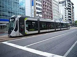
- Hiroshima Electric Railway
Roads
Expressways
- Chūgoku Expressway
- Hamada Expressway
- Hiroshima Expressway (urban expressway)
- Hiroshima Expressway (West Nippon Expressway Company)
- Shimanami Expressway
- Onomichi Expressway
- San'yō Expressway
National highways
- Route 2
- Route 31
- Route 54
- Route 182
- Route 183
- Route 185
- Route 186
- Route 191
- Route 261
- Route 313
- Route 314
- Route 317
- Route 375
- Route 432
- Route 433
- Route 434
- Route 486
- Route 487
- Route 488
Ports
- Fukuyama Port - International Container hub port
- Hiroshima Port - Ferry route to Miyajima, Edajima, Matsuyama, and Beppu, and also International Container hub port
- Kure Port - Ferry route to Edajima, Matsuyama
- Mihara Port
- Onomichi Port
Airports
- Hiroshima Airport
Sports
The sports teams listed below are based in Hiroshima.
American Football
- Hiroshima Hawks (Hiroshima City)
Football
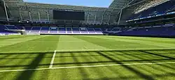
- Sanfrecce Hiroshima (Hiroshima city)
- Sanfrecce Hiroshima Regina (Hiroshima city)
Baseball
- Hiroshima Toyo Carp (Hiroshima city)
Volleyball
- JT Thunders (Hiroshima city)
Basketball
- Hiroshima Dragonflies
- Hiroshima Lightning (Defunct)
Handball
- Akitakada Handball Club (Akitakada)
- Hiroshima Maple Reds (Hiroshima city)
Cycling
- Victoire Hiroshima
Tourism
- Fukuyama Castle
- Hiroshima Peace Memorial
- Hiroshima Castle
- Itsukushima Shrine
- Jōdo-ji Temple
- Kure Portopia Park
- Mitaki Temple
- Miyajima Public Aquarium
- Momijidani Park
- Mount Misen
- Onomichi City Museum of Art
- Senkō-ji Temple
- Shukkei-en
-
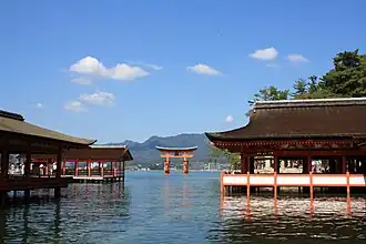 Itsukushima Shrine and Torii Gate (Hatsukaichi)
 -
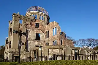 Hiroshima Peace Memorial (Hiroshima City)
 -
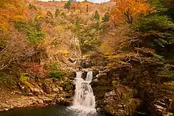
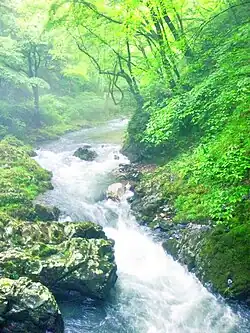 Taishaku Valley (Shobara)
 -
 Road of longing (Shokei no michi) in Takehara on October
 -
 Hiroshima Castle
 -
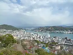
 Tomonoura (Fukuyama)
Famous festivals and events
- Onomichi Port Festival - held in April
- Hiroshima Flower Festival - held from May 3 to 5
- Fukuyama Rose Festival - held in May
- Enryuji Tokasan Festival - held in June
- Gion Festival of Onomichi - held in July
- Innoshima Water-naval Festival - held in August
- Miyajima Under-water Firework Festival - held on August 14
- Yassa Festival of Mihara - held in August
- Saijo Sake Festival - held in October
- Onomichi Becher Festival - held on November 3
- Hiroshima Ebisu Festival - held from November 18 to 20
International sister relations
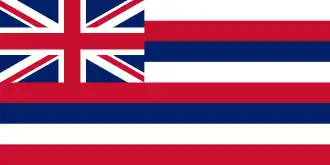 Hawaii, United States of America[13]
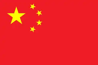 Sichuan Province, China[14]
Notes
- ^ "2020年度国民経済計算(2015年基準・2008SNA) : 経済社会総合研究所 - 内閣府". 内閣府ホームページ (in Japanese). Retrieved 2023-05-18.
- ^ NHK Broadcasting Culture Research Institute, ed. (24 May 2016). NHK日本語発音アクセント新辞典 (in Japanese). NHK Publishing.
- ^ Nussbaum, Louis-Frédéric. (2005). "Hiroshima-ken" in Japan Encyclopedia, p. 320 at Google Books; "Chūgoku" at p. 127 at Google Books.
- ^ 愛媛県~広島県の“隠れ県境”がまさかの日本最短!? 最長県境も愛媛県!? 意外と知らない県境の“魅力”と“可能性”. TBS News (in Japanese). 17 February 2025. Retrieved 31 August 2025.
- ^ Nussbaum, "Hiroshima" at pp. 319–20 at Google Books.
- ^ Nussbaum, "Province and prefecture" at p. 780 at Google Books.
- ^ Nussbaum, "Hiroshima Wan" at p. 320 at Google Books.
- ^ "General overview of area figures for Natural Parks by prefecture" (PDF). Ministry of the Environment. 1 April 2014. Retrieved 22 February 2015.
- ^ Statistics Bureau of Japan
- ^ "平成27年度広島県民経済計算結果について" (PDF). 広島県.
- ^ "平成 28 年経済センサス" (PDF). 広島県.
- ^ a b Religion in Japan by prefecture, 1996. English language bar table.
- ^ "Hawaii's Sister-States". State of Hawai'i. Archived from the original on October 16, 2020.
- ^ "県の外国との友好交流に関する問い合わせは" (in Japanese). Hiroshima Prefecture.
References
- Nussbaum, Louis-Frédéric and Käthe Roth. (2005). Japan encyclopedia. Cambridge: Harvard University Press. ISBN 978-0-674-01753-5; OCLC 58053128
External links
- Official Hiroshima Prefecture homepage
- Life in Hiroshima and other Japan-related Articles
- Hiroshima Weather Forecast
- National Archives of Japan ... Hiroshima map (1891)
- National Archives of Japan: Itsukushima kakei, illustrated scroll describing Itsukushima, text by Kaibara Ekiken (circa 1720)
- hiroshima-navi
Hiroshima (capital) | |||
| Hiroshima |
| ||
| Core cities |
| ||
| Cities |
| ||
| Districts |
| ||
List of mergers in Hiroshima Prefecture | |||